Maps
A guide to map resources and online maps
Nautical Charts
- NOAA Historical Map & Chart CollectionThe National Oceanic and Atmospheric Administration has historical aeronautical and nautical charts available at this site. You can find charts by either typing in a place name or clicking on a location on a map.
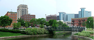
Local Maps
- City of Kalamazoo GISInteractive map for searching and displaying information about Kalamazoo. Scroll down and click on the "CONTINUE TO MAPPING" link.
- City of Kalamazoo Equalization DatabaseDetailed information about property assessments.
- City of Kalamazoo Crime StatisticsClick the neighborhood, choose the time frame and crime type, and click "map it." Statistics can also be viewed in table format.
- City of Portage GISInteractive map for searching and displaying informationn about Portage.
- City of Portage Equalization DatabaseDetailed information about property assessments.
- Kalamazoo County GISSimilar to the Kalamazoo and Portage GIS services, this mapping website allows you to view tax maps, a countywide generalized zoning map, aerial imagery from 2009-2013, a water table map, a map of areas that require a soil erosion permit and many other themes.
Click on the Continue to Mapping and I Agree to the Terms of Use links. - SWMRICA searchable database of real estate listings (commerical and residential) for southwest Michigan.
Other Online Resources
- Sanborn Digital MapsMaps of 300 Michigan towns and cities drawn at a scale of 50 feet to the inch, including street blocks and building numbers.
- Library of Congress Sanborn MapsThe Library of Congress has a growing collection of Sanborn maps. Currently these maps all date from before 1900. The maps are in color.
- University of Texas Map CollectionA major collection of scanned maps. Also provides links to Maps on Other Web Sites where one finds an extensive list of cyber-cartography.
- Digital Vector MapsFree outline maps of individual states.
- The Library of Congress American Memory collection.Maps from the Library of Congress.
- David Rumsey Map CollectionThis collection focuses on 18th and 19th century maps of North and South America but historical maps of the rest of the world are becoming a larger part of this online collection.
- National Geographic Map MachineOutline maps are available for printing and copying.
- Old Maps OnlineOld Maps Online serves as a gateway to a number of large collections of historical maps that have been digitized. A map on the screen serves as the interface with search results appearing in the right hand column. You can also search by place and limit by time period.
- MAGIRT Map Scanning RegistryThe Map and Geospatial Information Round Table (MAGIRT) of the American Library Association provides this list of map scanning projects. You can browse or search for projects covering areas of interest. It is notable because entries include basic technical information about the projects.
Census Maps
![]()
- American FactFinderAllows the user to display street maps that can include census geography and some basic thematic maps based on census data.
- TIGER Mapping ServiceFrom the U.S. Bureau of the Census provides basic road maps for the general user but also allows for the display of census related geography.
- Social ExplorerInteractive mapable Census data going back to 1940.
Topographic Maps
- USGS StoreDownload USGS topographic maps in GeoPDF format for free.
- ACME MapperSeamless topographic coverage of the entire United States. (Choose the layers from the menu in the upper right)
- Resources for Working with Topographic MapsThis collection from the USGS includes modules on the history, availability and use of topographic maps.